 Grid Globe
MGRS and UTM grids without Google Earth Pro
Google Earth Pro, the free desktop app, won't be offered for download after June 25, 2027. It was the free way to see an MGRS or UTM grid on a 3D globe: Google Earth on the web draws latitude and longitude gridlines only. Grid Globe draws both grids on a 3D globe in any browser, free, with no account and nothing to install.
See the MGRS grid on the globe See the UTM grid
What changes in June 2027
Google said in July 2026 that the Google Earth Pro app for Windows, Mac and Linux won't be available for new downloads from June 25, 2027. Google points to Google Earth on the web and on phones instead (Google Earth Help (opens in a new tab)), and confirmed to the press that a copy already installed keeps working (Android Authority (opens in a new tab)).
How the grid works in Google Earth Pro
- Open Tools › Options (on a Mac, Google Earth › Preferences) and choose 3D View.
- Under Show Lat/Long, choose Universal Transverse Mercator or Military Grid Reference System.
- Turn on View › Grid.
The grid then follows that choice, as do the coordinates at the bottom right (Google Earth Help (opens in a new tab), Google Earth Blog (opens in a new tab)).
The same in Grid Globe
| In Google Earth Pro | In Grid Globe |
|---|---|
| Show Lat/Long, one format at a time | The coordinates panel shows latitude and longitude, DMS, UTM and MGRS at once, for the point under the pointer or the one you pin |
| View › Grid | The picker above the globe: No grid, Lat/Lon, MGRS or UTM |
| The grid's lines as you zoom | Grid zones from space, then 100 km squares, then lines every 10 km, 1 km and 100 m, each labeled the way a map reader expects |
| Typing a coordinate in the search box | The same: an MGRS reference, a UTM coordinate or a latitude and longitude, read in your browser and sent nowhere |
| Saving a place | Copy link: the link keeps the view, the grid and a pinned point |
It works the same on a phone, where a crosshair at the middle of the map marks the point the panel reads.
What Grid Globe doesn't do
Grid Globe is a grid and coordinate tool, not all of Google Earth. It doesn't open KML or KMZ files, show historical imagery, measure distances or areas, play tours, save places, print or work offline. For those, keep your installed copy of Google Earth Pro, which goes on working, or try a desktop GIS such as QGIS (opens in a new tab), which is free, opens KML files and can draw a UTM grid on its maps.
Questions
Will Google Earth Pro stop working in 2027?
No. What ends in June 2027 is new downloads; a copy already installed keeps working.
Can Google Earth on the web show an MGRS or UTM grid?
No. It draws latitude and longitude gridlines only.
Do the two read the same coordinates?
Yes. Both work on WGS84, the datum GPS uses, so an MGRS reference or a UTM coordinate names the same point in each.
Is Grid Globe free?
Yes: no account, no ads, nothing to install. It is made by Hub Nexus, and About Hub Nexus says more.
Try it on the globe
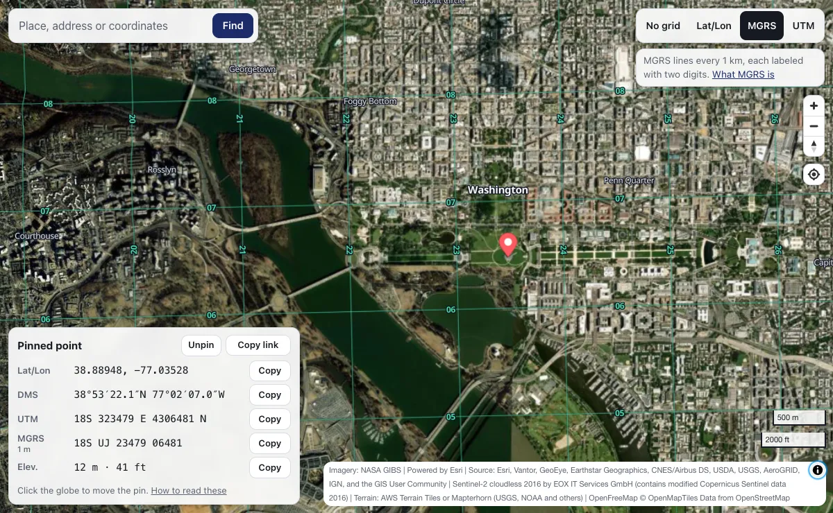
- The MGRS grid over Washington, DC, every kilometer labeled
- The 60 UTM zones from space
- Convert coordinates between the four forms